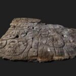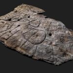
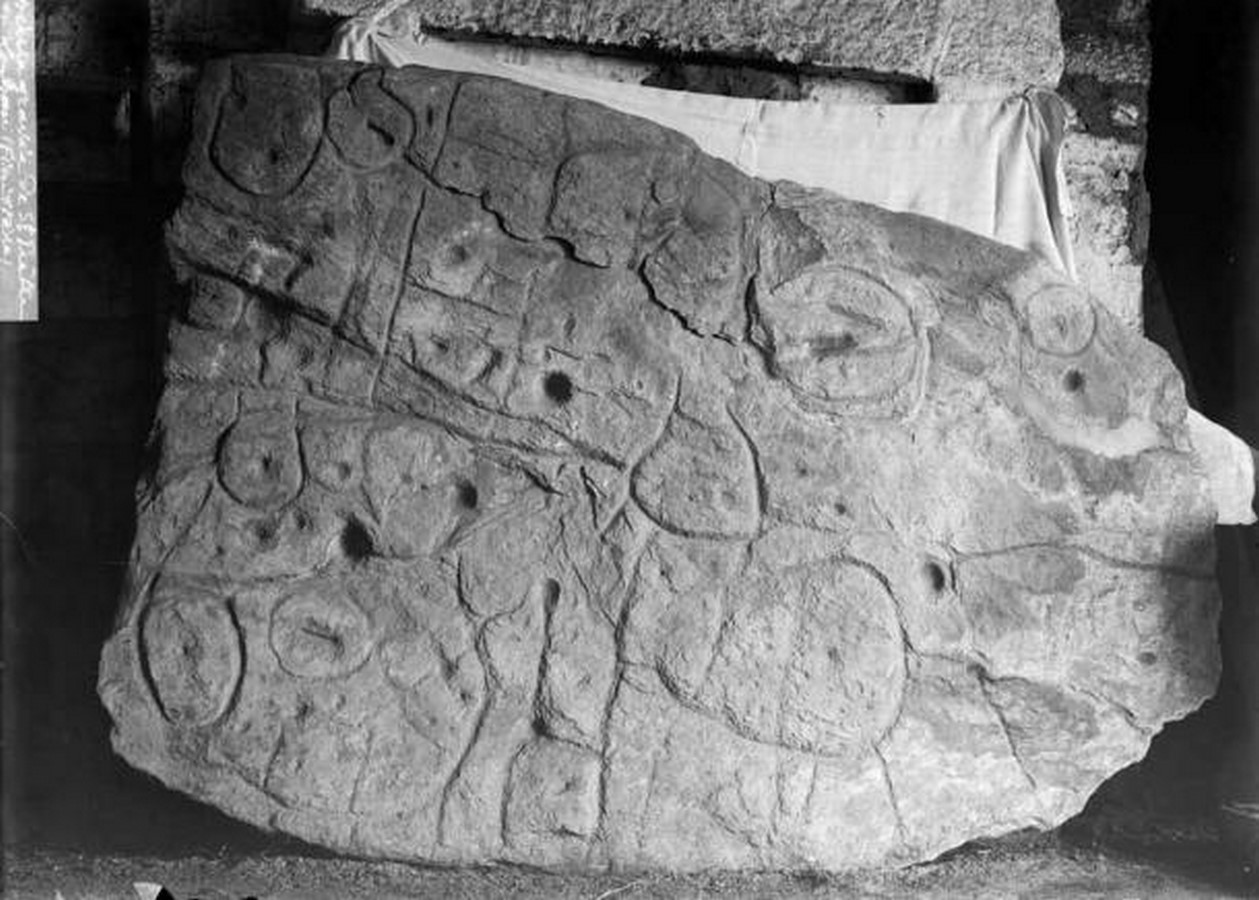
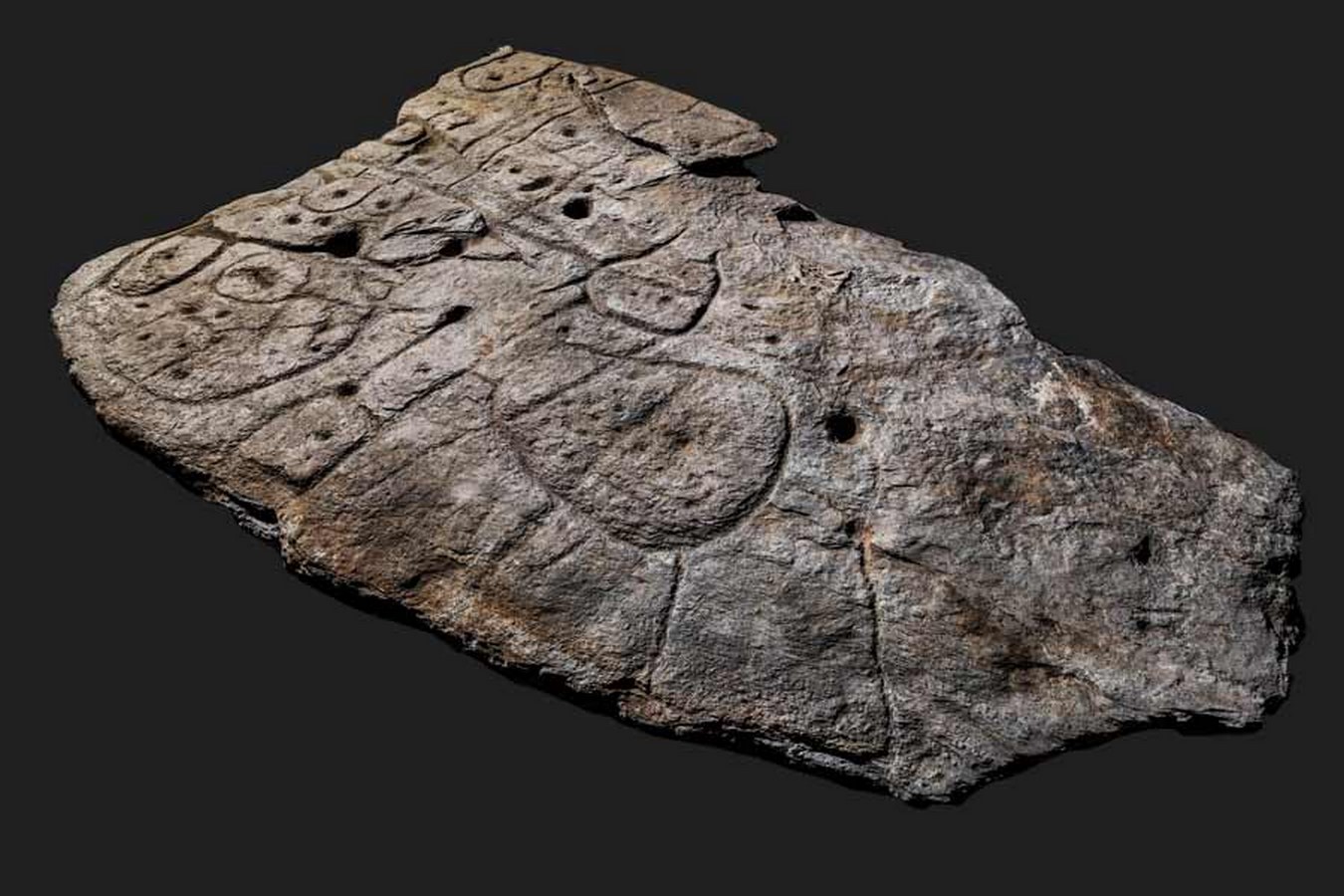
A piece of rock, adorned with cryptic markings for over 4,000 years, has emerged as a significant archaeological find – the Saint-Belec slab. This ancient artifact, hailed as Europe’s oldest map, is guiding researchers on a journey to uncover hidden archaeological sites in north-western France.
Deciphering the Ancient Map
Since its declaration as Europe’s oldest map in 2021, archaeologists have been diligently working to unravel the secrets of the Saint-Belec slab. Led by Yvan Pailler and Clement Nicolas, researchers aim to decode the intricate etchings on the slab, hoping to shed light on its origins and purpose.
A Novel Approach to Archaeology
Traditionally, archaeologists rely on advanced technology or chance discoveries to uncover ancient sites. However, the Saint-Belec slab presents a unique opportunity. Acting as a “treasure map,” the slab delineates an area spanning approximately 18.5 by 13 miles (30 by 21 kilometers), guiding researchers to potential archaeological hotspots.
Rediscovering Lost Monuments
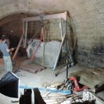
Pailler and Nicolas, part of the team that rediscovered the slab in 2014, have been working tirelessly to interpret its markings. The slab, initially unearthed in 1900 but overlooked for decades, is now yielding valuable insights into ancient landscapes and monuments.
Mapping Ancient Landscapes
Through meticulous surveying and cross-referencing with modern maps, researchers are piecing together the landscape depicted on the slab. The rugged patterns on the slab correspond to the rivers and mountains of Roudouallec, offering a glimpse into ancient Brittany’s geography.
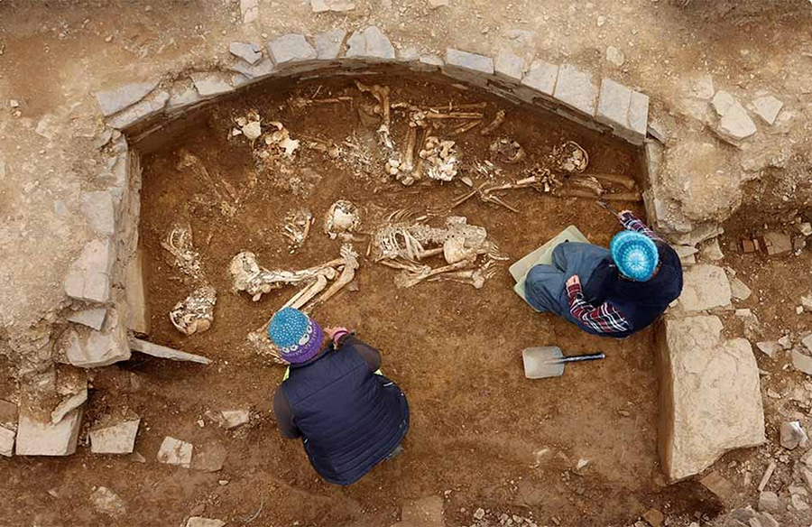
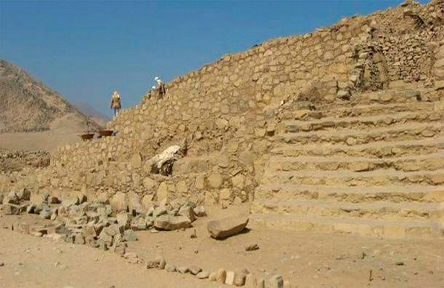
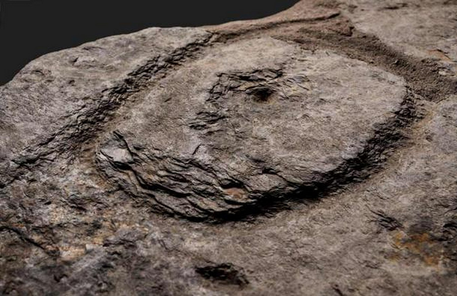
Uncovering Buried Secrets
The Saint-Belec slab features numerous hollows that researchers believe could indicate burial mounds, dwellings, or geological features. Deciphering these symbols may lead to the discovery of new archaeological sites, offering fresh perspectives on ancient communities.
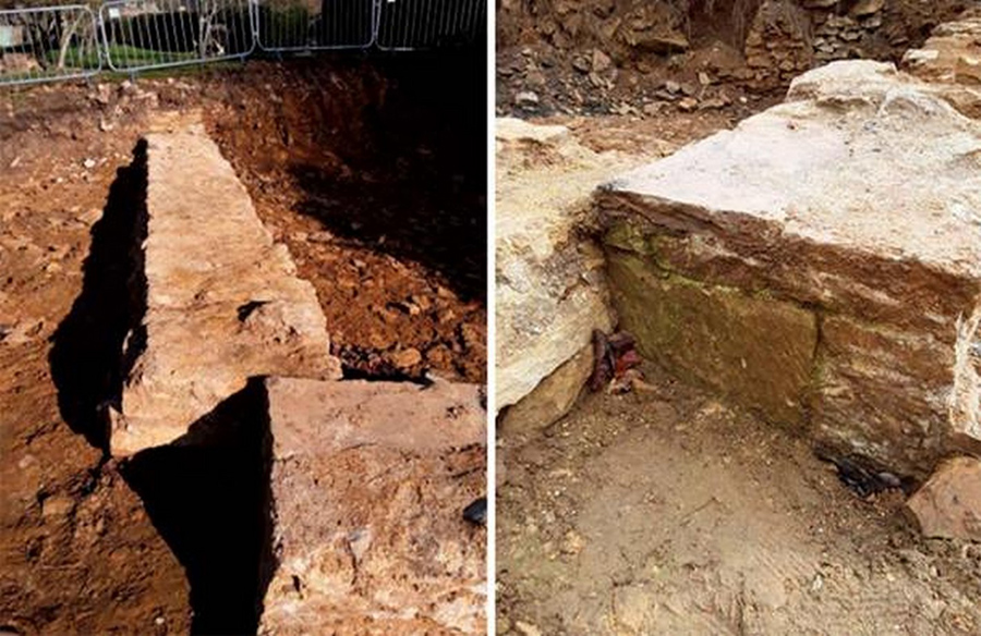
The Journey of the Saint-Belec Slab
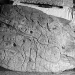
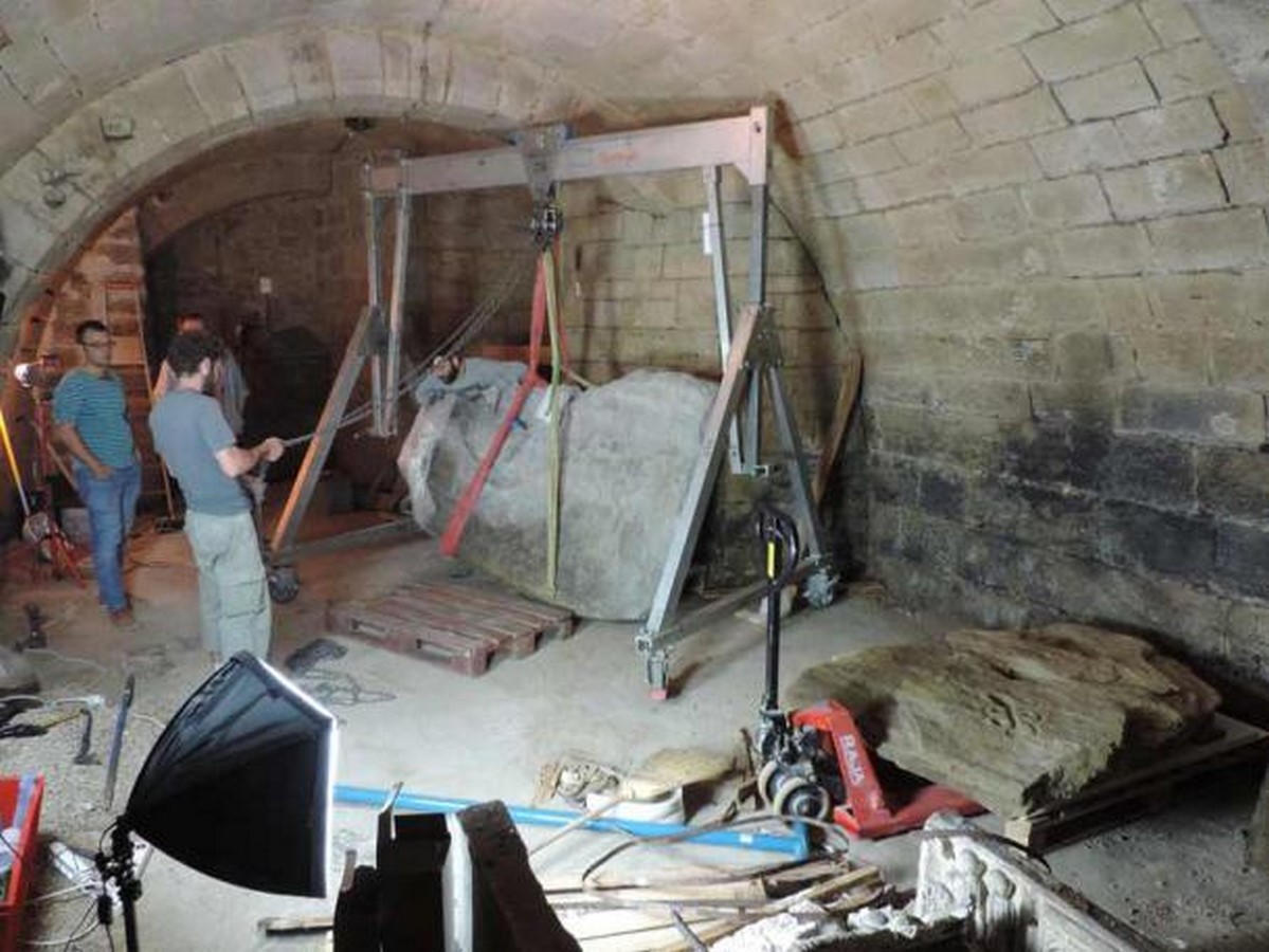
The journey of the Saint-Belec slab spans over a century. Discovered in 1900 by Paul du Chatellier, the slab was later acquired by the French Musée des Antiquités Nationales. Forgotten for decades, it was rediscovered in 2014, sparking renewed interest in its significance.
Unlocking the Past with Modern Science
Through photogrammetry and high-resolution surveys, researchers have gained new insights into the Saint-Belec slab’s morphology and technology. Complex patterns etched on the slab reveal a sophisticated understanding of cartography and spatial relationships.
A Window into Prehistoric Minds
The Saint-Belec slab challenges conventional views of prehistoric societies. Its intricate engravings and spatial organization suggest advanced cartographic skills and political aspirations. The slab’s discovery offers a rare glimpse into the minds of ancient peoples and their relationship with the landscape.
Conclusion: Preserving Ancient Heritage
As researchers continue to unravel the mysteries of the Saint-Belec slab, one thing remains clear – the importance of preserving our ancient heritage. Through interdisciplinary collaboration and cutting-edge technology, we can unlock the secrets of the past and enrich our understanding of human history.